Thursday, August 21, 2008

My Friends Have an Adventure

Some "as of yet unnamed" friends of mine had an adventure on a "big route on a sizable peak" somewhere in a Canadian mountain range.  This is how it ended up:

E. Ridge Epic 060 E. Ridge Epic 061

They're totally fine, though they have retired from big routes for a while.

Points if you can identify the mountain range, area, peak or the names of these folks!

Good Article on Short Rope Effectiveness

Here's a good article on the effectiveness (or not) of short roping on icy slopes > 25 degrees):

ShortRopeTests

In a nutshell, a short rope will not hold anyone who slips on an icy slope of 30 degrees. Period. Problems can be compounded with multiple people on a rope, when just one slips.

Tuesday, August 19, 2008

Radio options in the backcountry

Here's a good article (from Lou Dawson) on radio options in the backcountry.

Friday, August 15, 2008

Trevor's Visit

Just (finally) finished adding a couple of postings on my friend Trevor's visit to Vancouver in June:

Tuesday, August 12, 2008

Black Diamond Voodoo Ski Reviews

Lou Dawson's backcountry skiing website has had a thread on Black Diamond Voodoo skis - these are the ones I skied on last winter. Some good comments on these skis:

http://www.wildsnow.com/?p=1176#comment-10608

I added my own comment in there as well:

I skied on the Black Diamond Voodoos last winter as well, with Dynafit bindings.

Prior to the voodoos, I had a pair of Hagan Titanal skis - for me, I found that this skis didn’t have the flotation I was looking for in powder, they didn’t have the stiffness for awkward conditions, nor did they have the sidecut for tight turns in bushy trees (I live in British Columbia). The voodoo addressed every one of these issues for me, and I found it to be a great ski. The stiffness took a bit of getting used to, and I found I had to push the skis into the turn on hardpack.

On the topic of twintips - I don’t like them. The fact that you can’t easily stab a ski into the snow and use it as an anchor is a real inconvenience for ski mountaineering. As Lou pointed out, the twintips do feel different at the end of a turn - they seem to slide out of the turn more than I’d like - I’d prefer if it was a bit more “grabby”. (of course, this is just my personal observation - your mileage will differ!)

Finally, on the topic of quality … I had the exact same experience as freeheel above - the top sheet has been falling apart on the tails where the skins clip on. The skis look pretty beat up after just one year of skiing. I’ll contact BD about that and possibly return ‘em. Also, I found that the boot center mark did not align with the “true’ boot center (which was marked with a separate score). Caused some confusion for me with my ski tech.

All in all, I found the Voodoos to be great skis - if BD would ditch the twintips and improve the quality of the tail skin clips, it would be great.

Monday, August 11, 2008

A Shot of Brandywine

Killaine & I gave Brandywine mountain a shot today. Brandywine is a pleasant summit south of Whistler, on the same Cheakamus / Squamish divide as Cypress Peak. I'd climbed it once before several years ago. We were hoping we'd have a bit more luck on Brandywine than we had on Cypress Peak a week ago!

IMGP3374

The usual "truck at parking area" shot

For some peculiar reason, I chose to drive to the 2WD parking area, rather than the 4WD area (which is about 365m higher, and a couple of kilometres closer). This made the day a bit more challenging than it needed to be!

IMGP3375

Killaine hiking up the Brandywine trail

But, soon enough we got to the meadows. Still a bit of cloud lingering, but it cleared off through the day.

IMGP3381

Brandywine meadows

The route is reasonably straightforward - through the meadows, then head up easy slopes to the south ridge of Brandywine.

IMGP3389

Killaine climbing out of the meadows towards the ridge

IMGP3393

The summit beacons

But ... we started running out of time (due to taking the "long start"!). At about 3:00 pm we were still a little ways from the summit ... so we decided to head back.

IMGP3396

Great views from the upper ridge of Cypress Peak (center) and Tricouni (to the left).

IMGP3398

Killaine takes a "dance break" on the way down

IMGP3404

Beautiful flowers!

Finally, back to the truck at about 7pm. Then, all that was left to do was to grab some of the biggest rocks I could lift, and put them in the truck ... for our garden at home!

IMGP3414

A small load of rocks

Sunday, August 10, 2008

Mount Gardner

The weather forecast for today was kind of touch & go, so rather than investing the time to travel further afield, Killaine & I decided to head off to one of the islands on Howe Sound for a short hike.

We had originally planned on hiking up Mt. Liddell, on Gambier Island. But, the parking at the Horseshoe Bay ferry terminal was full, so we ended up changing our plans to take the car over to Bowen Island and hike up Mt. Gardner.

It's a pleasant hike up through the trees, with nice views across to Vancouver, and up the Sunshine coast. Only about 3 hours return - so left plenty of time for beers back down at Snug Cove.

IMGP3357

Killaine hiking up the easy trail

IMGP3364

View across to Vancouver from the top

IMGP3368

Killaine & I at the top

IMGP3371

View up the Sunshine Coast

Wednesday, August 6, 2008

Giving Cypress Peak a Shot

Killaine & I went out on "BC Day" (August long weekend - Monday) to try and climb up Cypress Peak.  Cypress Peak, not associated with Cypress Bowl, is a rocky peak on the Squamish/Cheakamus divide.

 IMGP3303

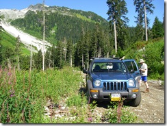
The logging road in was in really, really good shape!  We were able to easily drive all the way to the trailhead.


IMGP3306

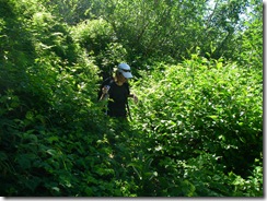
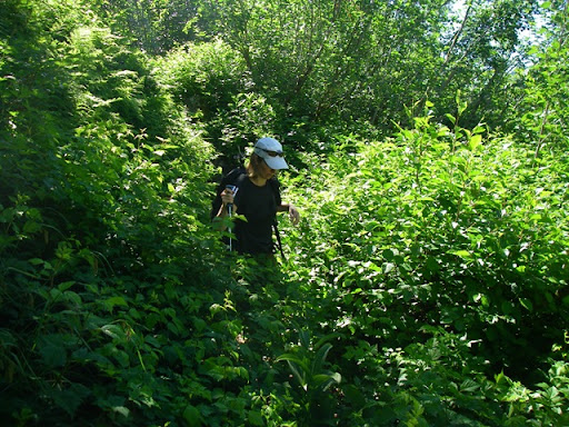
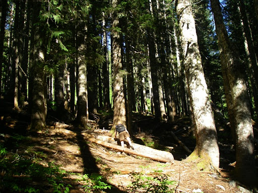
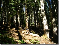
Killaine in the bush

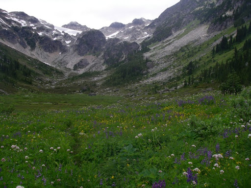
In spite of this picture, the bush, and time in the trees was completely minimal - maybe 15 minutes in trees 'til you break out into the open - then open hiking the entire rest of the way

IMGP3311

Killaine past the first snow field

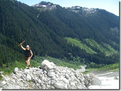
The route up was quite straightforward - boulder hopping along the side of the stream to the first snow field, then up a bit of steeper rubble to the glacier morraine area.

IMGP3316 

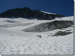
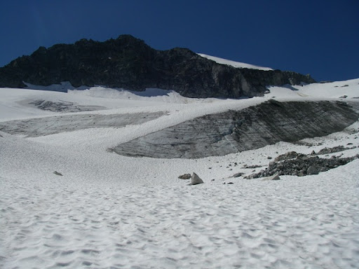
Cypress Peak above the glacier

The route continues under the toe of the glacier (not actually on the glacier).  Still lots of snow around.

IMGP3320

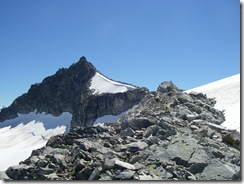
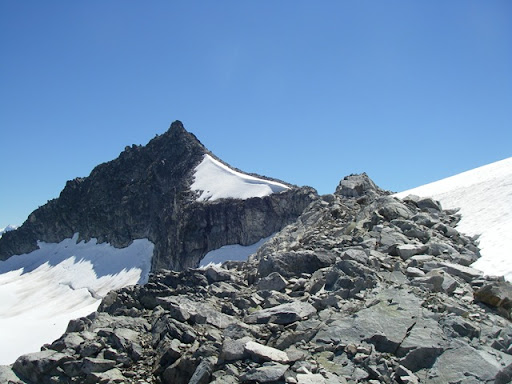
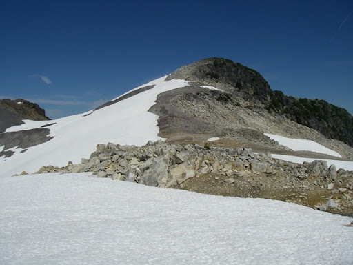
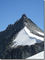
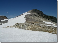
The peak from the ridge 

Finally, some broad snow slopes eventually put you on the upper ridge - the route to the summit is straight ahead!

IMGP3321

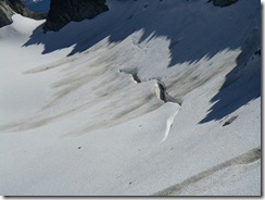
Bergschrund  below the peak

IMGP3323 IMGP3327

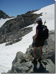
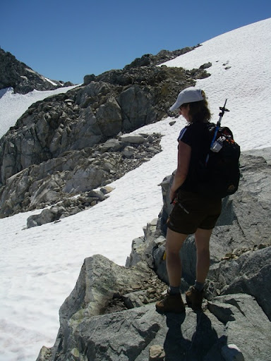
Killaine contemplates her self-arrest skills against the short gully traverse / bravely decides not to cross the gully.

However, there were still some steep-ish snow areas to cross.  Killaine didn't have alot of confidence in her self-arrest skills, so we decided it would be better to stop where we were.  Probably a good thing, 'cause there were some spots of tricky scrambling up ahead.

IMGP3324 IMGP3325

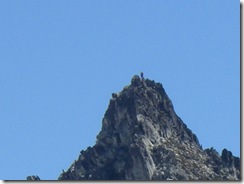
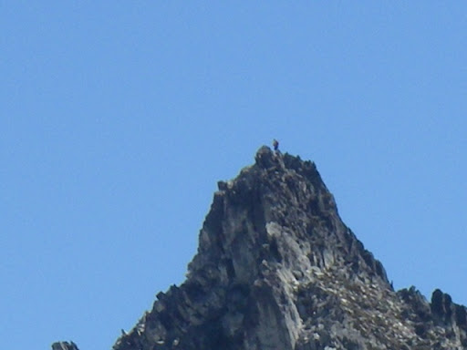
Mike, who we met at the start, on the summit (look closely).

IMGP3329

"Consolation Peak"

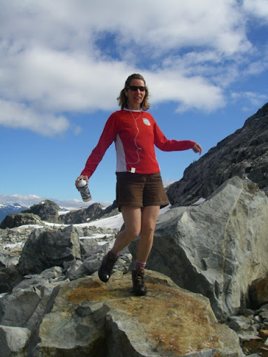
Instead, we walked the opposite direction along the ridge, and summited a small bump along it - easy scrambling up it, and nice views all around.

IMGP3340

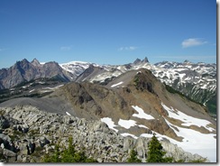
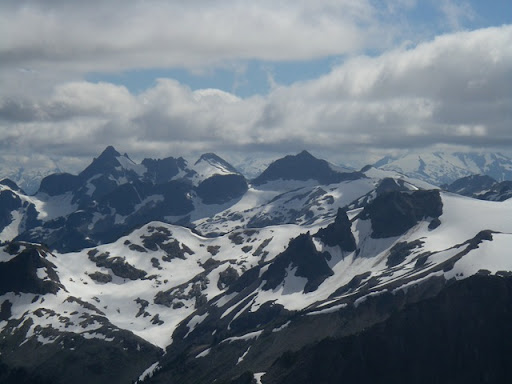
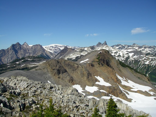
Looking north to Cayley / Fee / Vulcans thumb area (if I've got the names right)

The area up there is very cool - many interconnected ridges that you could spend a good couple of days exploring.  We'll be back to this area shortly to scramble up Brandywine peak (somewhere in the above picture as well).

IMGP3353

Climbing back through the trees to the logging road

So, although we didn't get the summit of Cypress, it was still a great hike in a very cool location ... and minimal time in trees!